
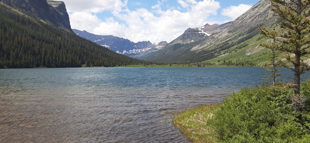
I thought I’d tell you a little about this next trail. The PNT was first thought up in the early 1970s. It crosses five geographic areas, including the Rocky Mountains, Columbia Mountains, North Cascades, Puget Sound, and the Olympic Peninsula. To learn more about these you can go to www.fs.usda.gov/detail/PNT/about /?cid=fseprd1056017
The PNT is different from most of the other national scenic trails in that it goes east/west instead of north/south. It climbs over every mountain range between the continental divide and the Pacific Ocean.
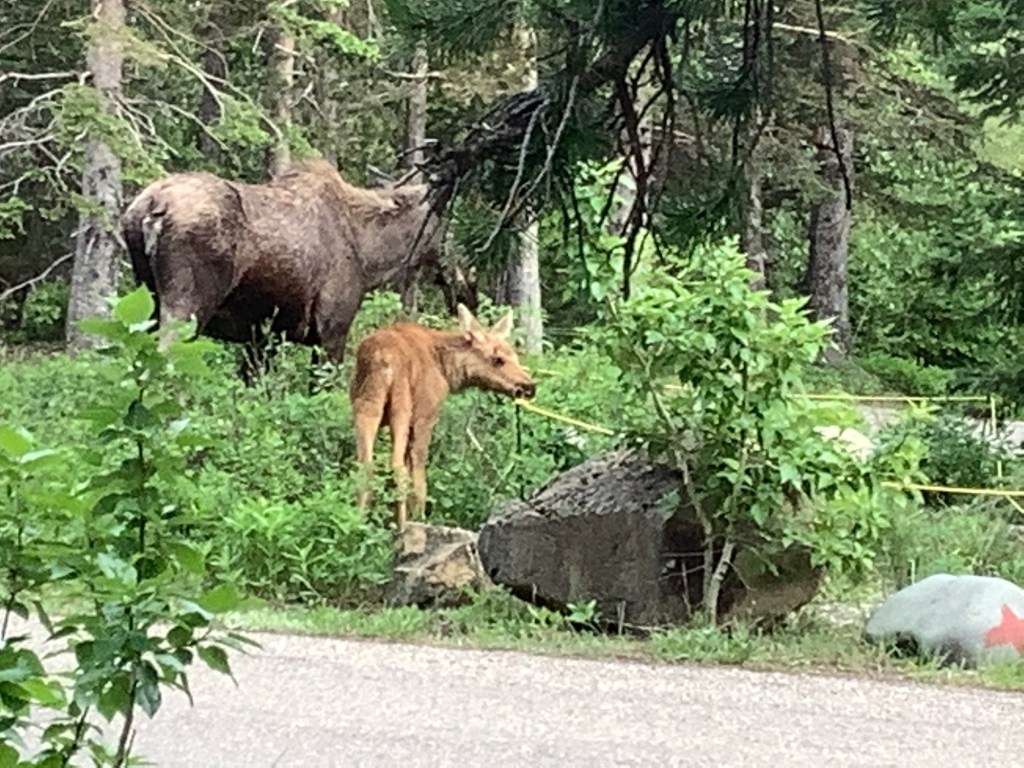
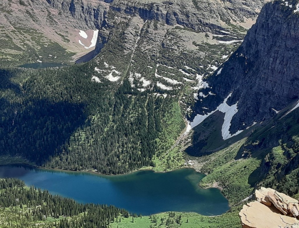
The PNT website describes it as one of the most scenic and rugged wilderness trails in the world, crossing three national parks, seven national forests and seven mountain ranges. In researching about the trail, I have continued to find warnings about potentially life-threatening situations. First they are the plethora of grizzly and black bears to be found on this trail. As on other trails, I’ll be contending with a variety of wild animals, including moose, who are considered more dangerous than bear when threatened. When I hiked the cdt, I was charged by moose four times and once I had to get out of my tent to get out of the way of a mother and her baby. I have experience hiking in grizzly bear country. My bear spray will be on my hip and I know how to use it.
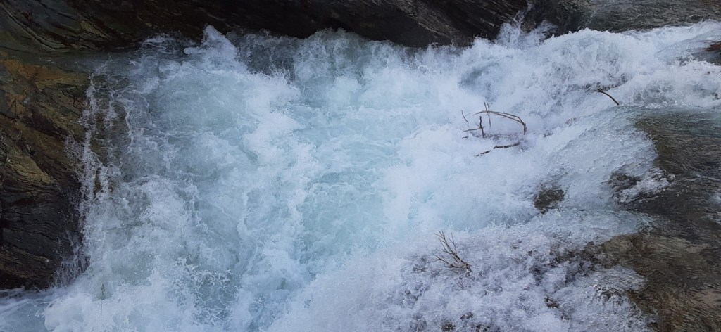
Then there are the water crossings. At least two of these fords are extremely dangerous unless the water is running low. On this trail, it is not uncommon for hikers to turn back and walk miles in the opposite direction rather than crossing certain waterways. I may have to wait until morning to cross some streams. The water is often lower then as the snow melt decreases during the cooler nights.

Certain times of year there is a lot of snow in the mountains making slabbing the side of a mountain treacherous. To minimize the danger of uncontrollably sliding down a steep snowfield, I carry spikes and an ice axe. The spikes give me some grip when walking on snow and the ice axe is held in my hand so that if I fall, I can use it to stop a potentially fatal slide. Just in this past week there has been more snow falling in Glacier, so I do expect to run into a fair amount of it.
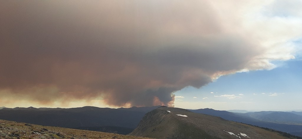
I have to watch out for lightning on high exposed ridges. When I hiked the continental divide trail, lightning caused my hair to stand on end four times. In addition, lightning often causes forest fires out here in the dry forests. I’ll have to constantly be alert to fires in the distance or smoke in the air. The aftermath of a fire leaves sections of the trail extremely dangerous to walk. Dead trees have been known to fall and kill hikers in these old burned areas.
When I reach the West Coast, I’ll be walking on the beach and have to be continually aware of the tides, not only high and low tide, but also the depth of high and low tide because certain places on the beach are impassible at certain tide levels. There are ropes hanging over the cliffs onto the beach so if a hiker gets inadvertently caught on the beach when the tide comes in, she can try to pull herself up the cliff with the rope. I’m hoping to avoid that, but may still add a pair of rubber gloves to my pack when I get close to the beach in case I do need to pull up on the rope.
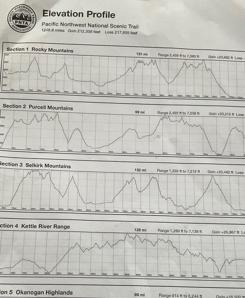
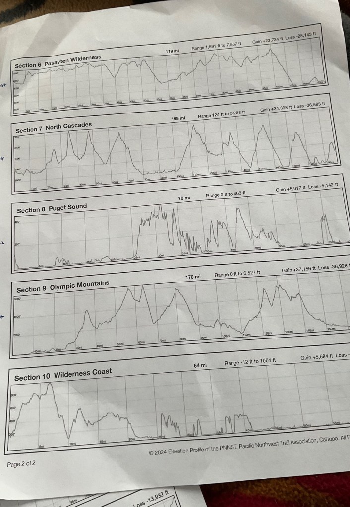
To complete the 1250 mile PNT, I will have to climb about 230,000 feet up and almost 236,000 down. When you divide that 230,000 over the half of the length of the trail, figuring that half of the trail is up and half down, you come up with an average of almost 400 feet of elevation change per mile. Of course these gains and losses are not consistent over the trail and there will be many steep ups and downs. There’s at least one place where I will climb from about 2000 feet elevation to over 8000. Luckily, I grew up on the East Coast and am used to a lot of steep ups and downs. The Appalachian Trail has more up-and-down per mile than any of the other national scenic trails. In general 1000 feet gain in a mile is considered fairly steep. I don’t know how many times I will be facing that on the PNT but I know it is the norm on the Appalachian Trail.
They say the average hiking time to complete the PNT is 68 days but I’m expecting to take closer to three full months. That will include some zeros and require an average of about 100 miles a week.

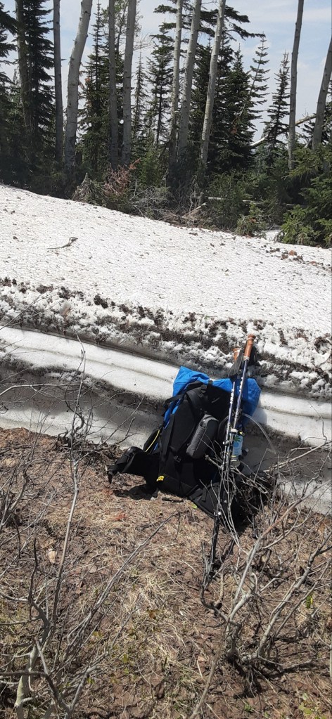
The Pacific Northwest Trail is fairly new and many sections of it are still being completed. As a result, there are some areas where hikers have to find their own way from point A to point B, often bushwhacking through prickers and other vegetation that is over one’s head. In some areas, fallen trees abound and climbing up and over them for more than six miles can take the better part of a day. There are also sections with class three rock scrambles requiring the use of hands.
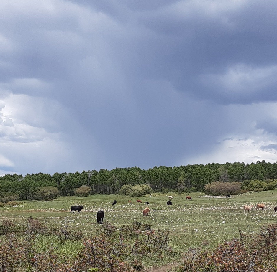
My understanding is that water will be more plentiful than it is on the Arizona Trail or the Continental Divide Trail, but there will be sections where it could be scarce. The weather can range from extremely hot to well below freezing and I certainly will have more rain on this trip than I did on the Arizona Trail. After all, I will go through a rainforest.
At first I questioned whether I was able to do this trail solo at my age. But as I researched it, I felt more confident that barring any unforeseen consequences, I will be able to complete it. I figure if other people can do it, so can I. Thanks to trail angels I have good gear. I will take my time when need be. I will take all the standard precautions to keep myself safe from the bears, including not eating near my tent and making a lot of noise when going through thick underbrush. I expect that by the end of this trail I will be sick of hearing myself sing. If any bear dares get near me while I’m singing, I feel sorry for it. I don’t know the sensitivity of a bear ears, but I know that it’s nose is many times greater than even a hound dog.

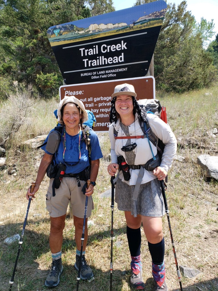
Through the Internet I’ve connected up with a 62 year old woman named Mary! She has been a trail angel on the PNT for years and decided that she wanted to give it a go. She has never thru hiked before but she is a hunter and has a lot of outdoor knowledge and experience. I will be picking her up as I drive to Glacier and we will start the trail together. If all goes well, we will form a tramily (trail family) and hike much of the trail together.
I will be going through at least one town that has no standard electricity and another one that has no cell service. As a result it might be longer between blog posts.
On the plus side, being as far north as I will be in the summer will grace me with much longer daylight hours so I might be able to hike at a more leisurely pace and still achieve my goal of about 15 miles a day and 100 miles per week. The views are reported to be wonderful on the PNT. And since I recently finished the Arizona Trail I’m in pretty good hiking shape.
I feel excited and ready to take on the challenge.
For those who are curious, I’m listing the towns that I expect to resupply in. You can coordinate these with the maps on the Pacific Northwest trail association website. And as always, thank you for hiking along with me.
Here’s a list of my resupply points. I’ll start in Glacier National Park, then go to Polebridge, Eureka and Yaak, Montana. Bonners Ferry in Idaho will be my next stop. Then Metaline Falls, Orient, Republic and Loomis all in Washington. After Loomis, I will begin a detour around a section of trail closed because of dangerous conditions left by a past fire. I’ll get off at Hart’s Pass on the Pacific Crest Trail and go into Mazama before making my way to Concrete, Washington. Here I work my way back to the PNT, next staying with a trail angel in Lyman, followed by another trail angel stop in Bellingham. Then I go through Anacontes, Port Townsend, Port Angeles and Forks before ending up at the western terminus of the PNT on Cape Alava.
From there, I will find a way to get to a train station and take the Amtrak back to my car in Glacier before wending my way back to Vermont, hopefully by the end of the first week in October.
Until then, wish me luck!
#pacificnorthwesttrail #PNT #thruhiking #IAT #iceagetrail #nationalscenictrail #potomacheritagetrail #natcheztrace #arizonatrail #CDT #continentaldividetrail #newenglandtrail #PCT #olderwomenhiking

Leave a comment